Cartographers or Photogrammetrist
Log In

Want to learn more? Check out these other resources:
Career Profile
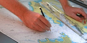
Maps can give us much more information than ways to get from A to B. Maps can give us topographic, climate, and even political information. Cartographers and photogrammetrists collect a vast amount of data, such as aerial data and survey data to produce accurate maps and models. For example, by collecting rainfall data, a cartographer can make an accurate model of how rainfall can affect an area's watershed. The maps and models can then be used by policy makers to make informed decisions.
Read more
Explore Our Science Videos

Video: How to Balance Anything

How To Build a Rube Goldberg Machine

Paper Ball Run: 2022 Engineering Challenge